Listen to this podcast for free in the app: Download for free in the App Store
radio.net
Sleep timer
Save favourites
285 episodes

Episode 286 - Liz Babcock
2026/07/13 | 1h 6 mins.Forty years in Land & Right-of-Way. An Enron survivor. A woman who earned her seat at the table in historically male-dominated industries. And, in her own words, someone who has spent her career “navigating a male-dominated world one martini at a time.”
This week, we sit down with Liz Babcock, Vice President of Land & ROW at ALTAEI, for a candid conversation about resilience, trust, relationships and what it really takes to succeed in the people-heavy world of land and right-of-way.
Liz shares lessons from four decades spent working with landowners, attorneys, engineers, agencies, utilities and energy companies—and explains why technical knowledge alone is never enough.
We also dive into:
How the Land and ROW profession has changed—and where progress is still needed
What surviving the Enron collapse taught Liz about reputation and resilience
How to build trust with skeptical or frustrated landowners
The importance of bringing ROW professionals into projects earlier
Earning your voice and your seat at the table
Why relationships, humor and genuine human connection still move projects forward
The stories and experiences that make a 40-year career truly meaningful
This episode is a reminder that successful projects are not built through data, documents and processes alone. They are built through trust, communication, judgment and treating people right.
Because the best ROW professionals do not just help projects acquire land—they protect relationships, reduce risk and create a path forward.
Music by Prince!!
#TheGeoholics #LandSurveying #RightOfWay #ROW #LandAcquisition #Geospatial #Surveying #Infrastructure #Leadership #WomenInLeadership #WomenInEnergy #ProfessionalDevelopment #CareerLessons #RelationshipBuilding #ProjectManagement #Prince #WhenDovesCry #PodcastEpisode 285 - Trent "TK" Keenan & Ryan "Big Shoots" Kelly
2026/07/08 | 2h 8 mins.The guys are joined by TK and Big Shoots for a full-circle conversation about where The Geoholics started, what it has become, and why this crazy little show continues to resonate with surveyors, mappers, photogrammetrists, tech leaders, mentors, troublemakers, and everyone else trying to move the profession forward.
This episode gets into the early days of the show, the raw and scrappy chemistry that made it work, the guests and moments that left a mark, and the bigger mission that has always been at the heart of it all: adding value and making friends.
We also dig into the future of surveying, mentorship, recruiting the next generation, technology, AI, drones, scanners, mobile mapping, and the role of professional judgment in a world moving faster than ever. Because the best surveyors are not just button-pushers — they understand the why behind the workflow, the risk behind the data, and the responsibility behind every deliverable.
Big Shoots is back behind the mic. TK brings the fire. Kent and Sean keep it moving. Buckle up…this one is a ride you don't want to miss!
Huge thanks to this week’s featured partners: EMLID, TopoDOT, AllTerra Central, Leica Geosystems, David Evans & Associates, and DBLS.
Music by Lainey Wilson!
Until next time…add value, make friends, and most importantly, be safe and healthy!
#TheGeoholics #Surveying #LandSurveying #Geomatics #Geospatial #Mentorship #RealityCapture #MobileMapping #Photogrammetry #LiDAR #SurveyLife #ProfessionalSurveyor #FutureOfSurveying #AddingValueMakingFriendsBLM ID - Boise Meridian Initial Point Celebration
2026/07/02 | 1h 58 mins.The BLM Idaho, alongside the Idaho State Historical Society and various mapping partners, hosted the Boise Meridian Initial Point Celebration on May 1 and 2, 2026. The signature event commemorated the 1867 founding of Idaho's survey grid and America’s 250th anniversary at the Old Idaho Penitentiary.
The community event honored the cadastral surveyors who defined the state's boundaries and set the Public Land Survey System for nearly 54 million acres. The Geoholics were honored to play a small part in this awesome celebration!
Here are the folks we were honored to chat with throughout the day:
Josh Strege, Land Surveyor @ BLM
Taylor Stanton, Director Communications and Marketing @ Foundation for America's Public Lands
John Quincio, Amateur Radio Operator
Tasha Huhta, Land Surveyor @ BLM
HannaLore Hein, Idaho State Historian, Idaho State Historical Society; Vice Chair, America250 in Idaho Task Force
Christian Courtial, Land Surveyor @ BLM
Stuart Ward, Owner @ Dioptra
Music by Johnny Cash!Episode 283 - Karen Schuckman
2026/06/26 | 1h 22 mins.This week on The Geoholics, we sit down with Karen Schuckman, Subject Matter Expert in Remote Sensing and Geospatial Services at RRC Companies—and someone who has had a front-row seat to the evolution of modern lidar and airborne mapping.
Karen takes us back to the early days of airborne GPS, before IMUs became standard, and shares how she helped develop groundbreaking data-processing workflows following Hurricane Floyd and supported North Carolina’s pioneering statewide lidar program. We also explore her work supporting major FEMA initiatives, her passion for positional accuracy and data quality, and the continued importance of understanding geodesy, datums, projections and metadata.
This conversation goes well beyond lidar. Karen shares valuable lessons about:
Turning emerging technology into trusted, defensible deliverables
Why industry standards and ASPRS guidance matter
The fundamentals professionals still cannot afford to overlook
Helping engineers effectively use survey-grade geospatial data
What lidar’s evolution can teach us about AI, automation and digital twins
The mindset required to adapt, evolve and stay relevant in a rapidly changing profession
We also discuss what even experienced professionals still misunderstand about lidar, which technologies never lived up to the hype, and what continues to excite Karen after more than two decades of pushing the geospatial profession forward.
Oh—and did we mention Karen was an alternate gymnast for the 1972 Olympics? This episode delivers history, technology, education and one incredible career journey.
Buckle up for Episode 283 and join us as we add value, make friends and explore how accurate geospatial data gets to the right place on the ground.
Music by Jethro Tull!
#TheGeoholics #LiDAR #RemoteSensing #Geospatial #LandSurveying #Geomatics #Photogrammetry #Mapping #GIS #Geodesy #DataQuality #PositionalAccuracy #DigitalTwins #ArtificialIntelligence #SurveyingTechnology #ASPRS #CareerDevelopment #GeospatialLeadership #PodcastEpisode 282 - Tom Yeshurun & Civ Robotics
2026/06/16 | 1h 17 mins.On Episode 282 of The Geoholics, we sit down with Tom Yeshurun, CEO of Civ Robotics, to explore how automation is transforming construction layout—and what that evolution means for surveyors, contractors, field crews, and the future of the geospatial profession.
Tom shares the real-world frustrations that inspired Civ Robotics, the company’s bold pivot from drones to ground-based robots, and the challenges of earning trust in an industry where accuracy, accountability, and boots-on-the-ground experience still matter. We dig into the line between surveying and construction layout, the productivity and profitability unlocked by robotic point placement, and why automation should elevate field professionals rather than simply replace them.
We also look ahead to the fully connected jobsite—where robotics, machine control, digital twins, and human expertise converge—and discuss the skills today’s young surveyors and geomatics professionals will need to remain valuable in an increasingly automated world.
Precision gets you started. Automation makes you faster. Verification keeps you out of court.
Music by Led Zeppelin
#TheGeoholics #CivRobotics #TomYeshurun #ConstructionRobotics #RoboticLayout #ConstructionTechnology #ConTech #LandSurveying #Surveying #Geomatics #Geospatial #ConstructionLayout #Automation #DigitalTwins #MachineControl #FieldTechnology #RealityCapture #FutureOfConstruction #Innovation #Surveyors #AECIndustry #BuiltEnvironment #LeicaGeosystems #Emlid #TopoDOT #AllTerraCentral #AddingValueAndMakingFriends
More Business podcasts
 Aspire with Emma GredeBusiness, Entrepreneurship, Society & Culture
 The Diary Of A CEO with Steven BartlettBusiness, Education, Society & Culture
 Bruce Whitfield’s Business WeekBusiness
 BizNews RadioBusiness, Business News, Investing, News
 Money with CarlaBusiness, Investing
 RSG Geldsake met MoneywebBusiness, Investing
 Think Fast Talk Smart: Communication TechniquesBusiness, Careers, Comedy, Education, Improv, Language Learning
 A Bit of OptimismBusiness, Careers, Education, Self-Improvement
 FoundersBusiness, Entrepreneurship, History, Technology
 The Money ShowBusiness, Business News, Investing, News
Trending Business podcasts
 The Compound and FriendsBusiness, Business News, Investing, News
 NavalBusiness, Education, Investing, Science, Technology
 EntreLeadershipBusiness, Entrepreneurship
 The Called PodcastBusiness, Education, Entrepreneurship, Self-Improvement
 Building Wealth Without BordersBusiness, Education, Entrepreneurship, Investing, Self-Improvement
 Reuters Morning BidBusiness, Business News, Investing, News
 The Property PodBusiness, Business News, Investing, News
 Hot Smart Rich with Maggie Sellers ReumBusiness
 Bloomberg BusinessweekBusiness, Business News, News
 The Enlightened Podcast by Luyanda KhumbuzaBusiness, Careers, Education, Self-Improvement, Tutorials
 In Good Company with Nicolai TangenBusiness
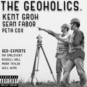
About The Geoholics
”Adding Value & Making Friends” since 2019! Our goal is to not waste your time! The group discusses a variety of topics including surveying, geospatial, geomatics, GIS, civil engineering and much much more.
Podcast websiteListen to The Geoholics, Aspire with Emma Grede and many other podcasts from around the world with the radio.net app
Get the free radio.net app
- Stations and podcasts to bookmark
- Stream via Wi-Fi or Bluetooth
- Supports Carplay & Android Auto
- Many other app features
Get the free radio.net app
- Stations and podcasts to bookmark
- Stream via Wi-Fi or Bluetooth
- Supports Carplay & Android Auto
- Many other app features

The Geoholics
Scan code,
download the app,
start listening.
download the app,
start listening.
The Geoholics: Podcasts in Family